Zone V
Zone V
Defined by Decree No. 16-93, on January 22, 1993, encompasses the provinces of Monte Cristi, Dajabón, Santiago Rodríguez and Valverde, corresponding to the Northeast sub-region or the Western Cibao of the Dominican Republic. Its area is 4,879 square kilometers for a population of 387,712 inhabitants.
With fertile land enriched with minerals, Monte Cristi is the province with the largest area in the tourism zone, 1,924 square kilometers and a population of 95,705 people, followed by Santiago Rodríguez, with 1,111 square kilometers and 62,144 inhabitants; Dajabón, with 1,020 square kilometers has a population of 68,606 inhabitants; and finally Valverde, which has an area of 823 square kilometers and an approximate population of 153,050 inhabitants.
Monte Cristi was discovered by Admiral Christopher Columbus on his first journey, which entered the name in the chronicles of the New World a few days after the discovery of the Island, when the sailor expressed the beauty and richness of the place and gave it the name that it still carries.
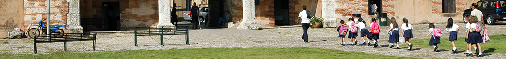
The province’s principal city is San Fernando de Monte Cristi, founded in the 16th century, during the government of the General of Lares, Friar Nicolás de Ovando. It currently has a population of 20,259 inhabitants, on an area of 524 square kilometers. A prosperous port and commercial city, it came to be an important economic center. In 1606, the governor at the time, Antonio de Osorio, by royal decree, destroyed the cities on the northern seaboard, in order to end the contraband industry that the settlers of the region held with the sailors on Dutch and Portuguese ships that frequently visited those ports. Some time after, the brigadier Rubio y Peñaranda reconstructed and repopulated the city with families from the Canary Islands.
One important historical event in the history of the city was the writing of the “Manifesto of Montecristi”, on March 25, 1885, signed by General Máximo Gómez and Cuban liberator José Martí, reaffirming the brotherhood of the Dominican and Cuban peoples.
This province has great diversity in its soil, where we can find highlands areas situated between orographic systems and various coastal plains, as well as lowlands that make up the Valle del Noroeste with various irrigation sources, including the main source of the Río Yaque del Norte. It offers, in addition, a great variety of flora and fauna, from desert plants, forests of fruit trees, palms, mangroves and a variety of vegetables and natural grasses.
Its agricultural production is composed of rice, plantains, bananas, melons, tomatoes and other minor fruits. Cattle raising is also an important aspect of its economy, especially the raising of caprino, a bovine famous for its taste due to its feed, composed of aromatic grasses.
The salt mines are another important productive activity, as they contribute their characteristic stamp to the seascape. Among the many attractions and natural wealth of Monte Cristi, the Parque Nacional de Monte Cristi stands out, as it is in the category of dry subtropical forest, with an abundant variety of vegetation and fauna, with 11 species of reptiles, including the American crocodile, numerous birds, among them the pelican, the flamingo, the sheartail, the pigeon and the tern. Seven cays, named “Los Siete Hermanos, are witnesses to the phenomenal bird migration that arrive each year from Florida to make their nests in the warm and welcoming Dominican lands.
The Caño de Estero Hondo, configured in the shape of an inverted “T”, is noted for its wide biological diversity. Its waters provide for the survival of the manatee,. The mangroves and waters of the canal form majestic marine avenues that can be traveled by a small boat in the protected area.
The Morro has an impressive majesty and beauty, from which one can view the entire bay with its cays and system of coastal lakes. It is a scene that provokes wonder in all of the senses. Columbus was so impressed with the terrain that looks out onto the sea that in his diary, he wrote the following: “This Monte Cristi is very beautiful and high and walk-able, of such a lovely form and to stay here up high, seeing it from afar, it seems an Island that does not have any connection with any land…”.
Among other areas of tourist interest, the navigable canals, covered with mangroves should be mentioned, as well as the scientific reserve Villa Elisa, the famous clock of the past century, the museum of Máximo Gómez and José Martí, and the Victorian architecture that we can still admire through the streets of the city.
Regarding the province of Dajabón, whose principal city is of the same name, it was founded on the 18th century, during the government of don José Solano y Bote. It has a population of some 22,446 inhabitants and an area of 341 square kilometers. It was the scene of various heroic gestures that contributed to the independence of the country It is the only city in the Northeast region of the country that borders Haiti and it is notorious for a certain cultural mixing, which manifests itself in the city’s culture and customs.
Its economy is essentially agriculural: among its principal crops are rice, tobacco, beans, coffee and, on a smaller scale, onions, plantains, pigeon peas and bananas.
Other important activity in the northeastern province is cattle raising. In recent years, the commercial activity has shown considerable growth, supplying, in part, the consumer market of Juana Méndez, Haití, through popular sales gatherings known as “Fairs”.
Dajabón has various tourist attractions, mostly ecological, due to the diversity of the ecosystems, like the Parque Nacional de Nalga de Maco and the Salto de Balneario of Loma de Cabrera. The Centro Ceremonial y de Arte Rupestre Prehispánico of Chacuey is very interesting, as is the monument to the Restoration in Capotillo, the intramountain Valle del Río Limpio of Restauración, and the border line with the bridge of Dajabón.
The principal city of the Santiago Rodríguez province is San Ignacio de Sabaenta, founded by residents of Dajabón in the middle of the 19th century. It has a population of 46,300 people in an area of 948 kilometers squared. Its main economic activity is agriculture and its most important products are rice, tobacco and other minor fruits.
Among its main attractions are the national parks of Nalga de Maco, Armando Bermúdez and José del Carmen Ramírez, the springs of the Río Guayubín and the Río Mao, the workshops on casabe making, its handicraft workshops and its gorgeous mountains.
The Valverde province has three municipalities, with Mao as its main city, with a population of approximately 68,786 people and an area of 415 square kilometers. It was founded in the early 17th century, as a consequence of the Osorio evictions along the northern seaboard, to avoid the continuing contraband trade that the natives carried out with Dutch and French sailors. The evicted settlers founded cattle ranches in various points of the Cibao, among them Mao, on the shores of the river of the same name. The citizens and visitors of the city call it “The City of Beautiful Sunsets”. With flat and fertile land, it also possesses two excellent irrigation canals. The principal economic activity is agriculture and livestock, and its main product is rice. Other products are: bananas, corn, yucca, various grains, tobacco and other minor fruits.
Its principal tourist attractions are the famous Route of Columbus or Paso de los Hidalgos. It is said that upon arriving to La Isabela, Admiral Columbus sent the noblest of his companions to open a pass into the interior of the island and these, assisted by the Indians, arrived to a stop in the mountains that since has been named Paso de los Hidalgos. Valverde also have mountains with incredible landscapes, handicrafts, springs from the Mao and Amina rivers, indigenous cemeteries and its Victorian architecture, among other attractions.
Monte Cristi
Dajabón
Mao

Quick Links
Connect With Us!
You can keep updated with our news, events and activities through our digital channels using:
![]()
![]()
![]()
Keep Me Updated!
Keep up with the latest Dominicanaonline events and publications. Fill in your email details on this simple form and we will send you news and updates direct to your mailbox.
Register Now!