
Comunidad Dominicana en EEUU frente a Covid-19
Visitar el website >
Eventos y Actividades

Talking Plants
Donde: Casa de Teatro
Día: sábado 06 de abril del 2024
Hora: 8:00 p.m.
Lugar: C/ Arzobispo Meriño No.110. Ciudad Colonial. Santo Domingo
Teléfono: 809-689-3430
Boletas disponibles en: www.tix.do
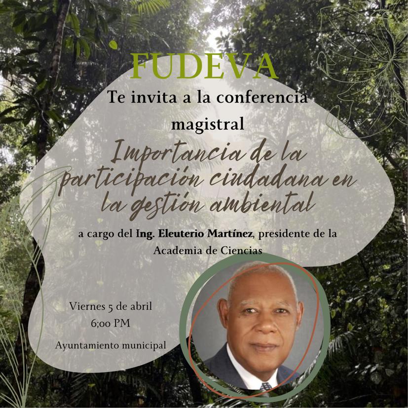
La Fundación para el Desarrollo de Villa Altagracia (FUDEVA) te invita a la conferencia magistral “ Importancia de la participación ciudadana en la gestión ambiental”
Donde: Salón Ayuntamiento Municipal de Villa Altagracia
Día: viernes 05 de abril del 2024
Hora: 6:00 p.m.
Lugar: Av. Duarte No.45. Villa Altagracia
Teléfono: 809-559-6226 / 809-559-4215

Conferencia titulada: “Tomás Bobadilla y Briones: Primer presidente de la República Dominicana”
Donde: Museo Nacional de Historia y Geografía
Día: jueves 4 de abril 2024
Hora: 11:00 A.M.
Lugar: C/ Pedro Henríquez Ureña, Plaza de la Cultura Juan Pablo Duarte, Santo Domingo
Teléfono: 809-687-6452
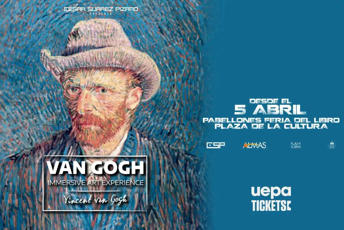
Espectáculo multimedia “Van Gogh Immersive Art Experience”
Donde: Pabellon Feria del Libro Plaza de la Cultura
Días: De 5 al 26 de abril del 2024
Horario: 3:00 p.m. a 10:00 p.m.
Lugar: Av. Máximo Gómez No.35, Plaza de la Cultura Juan Pablo Duarte
Entrada general: RD$690.00 p/p
Boletas a la venta en: https://uepatickets.com/

La casa de Bernarda Alba
Donde: Sala Manuel Rueda, Escuela de Bellas Artes
Días: 5, 6, 13 y 13 del 2024
Hora: 8:30 p.m.
Lugar: Av. Máximo Gómez esq. Independencia. Gazcue. Santo Domingo
Teléfono: 809-218-0101
Boletas a la venta en: https://uepatickets.com/
Ultimas noticias
Inauguración de la XII Feria Semana de la Geografía 2024
April 16, 2024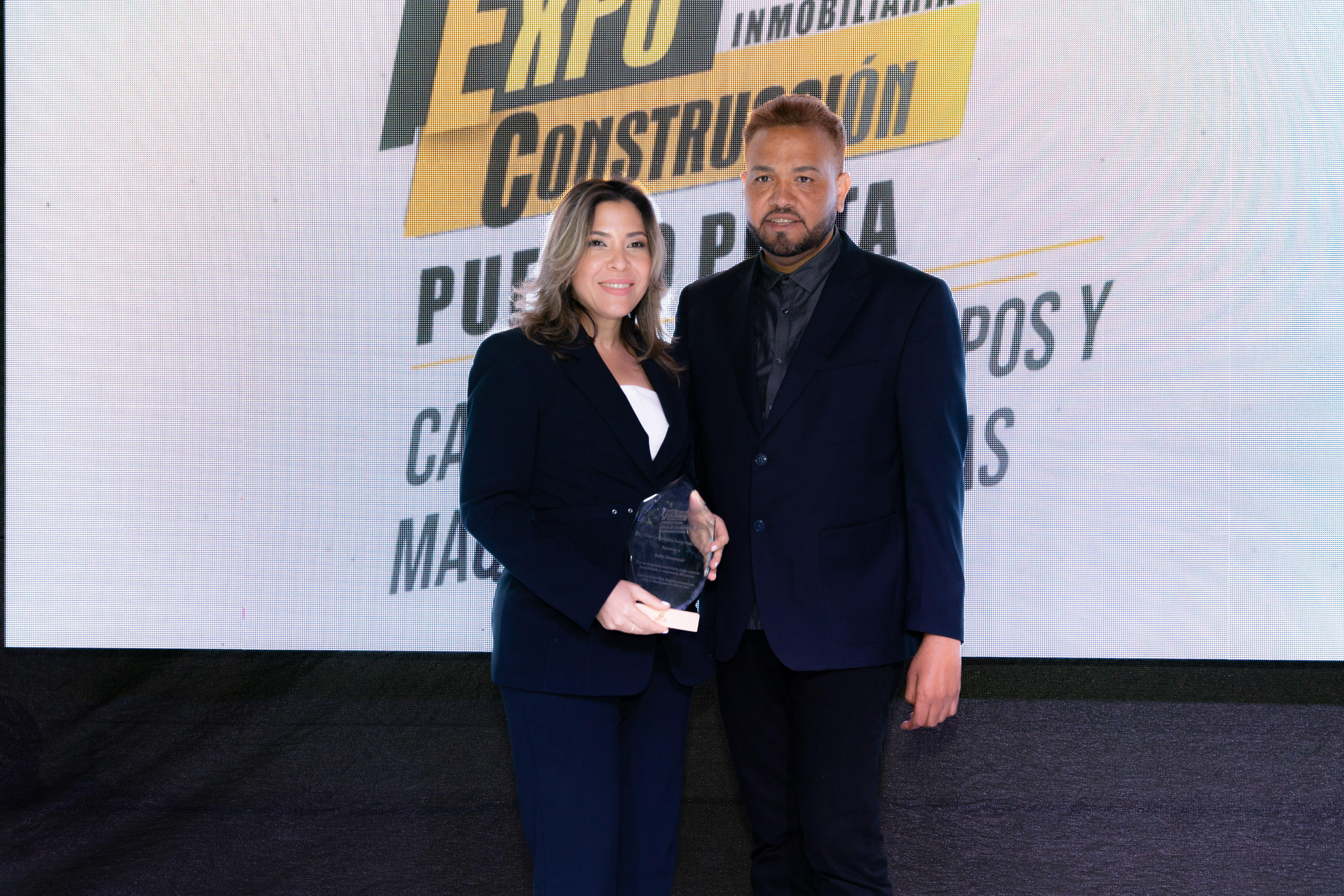
Sector construcción dominicano reunido este fin de semana en la IV Expo Construcción Puerto Plata
April 15, 2024
Médico Express será pionero en RD con certificación de excelencia para turismo médico
April 12, 2024
Realizan premiere de la nueva película "Canta y no Llores", coproducción entre República Dominicana – España
April 9, 2024- Ver todas las noticias
-
Dominicanos en Grandes Ligas
Las ultimas noticias/novedades de lo que acontece con los Dominicanos en las Grandes Ligas durante toda la temporada 2024
¿Sabías qué?
Santo Domingo cuenta con varias primicias de América, tales como: primera ciudad española en América, primera misa y primer ayuntamiento en el Nuevo Mundo (en la Isabela), primera catedral de América, primer palacio virreinal, primer cabildo que funciona desde la colonia, primer hospital, primera torre del homenaje, primer edificio de las Casas Reales, primera universidad, y primera casa de contratación.
Libros y Publicaciones (Ver todos)
-

Lo Dominicano I All Things Dominican
Una publicación de GFDD / Funglode de lectura ligera y fresca, bilingüe (español e inglés), que presenta las principales facetas de la dominicanidad, los recursos naturales y la cultura del país, desde una perspectiva moderna e innovadora, de fácil comprensión, con énfasis en informaciones curiosas y poco conocidas.
Disponible en Amazon -

Nuevas Perspectivas: República Dominicana
Compuesto por 400 fotos aéreas tomadas desde el cielo, el libro se divide en nueve capítulos ─Reflejos, Costas, Alturas, Planos, Ciudad, Turismo, Historia, Trabajo y Gente─, que contienen textos sobre distintos aspectos de la historia del país, su cultura, el medio ambiente y la vida contemporánea.
Disponible en Amazon -

Diccionario Enciclopédico Dominicano de Medio Ambiente
Una guía, de la A a la Z, del medio ambiente y los recursos naturales de la República Dominicana. Sus 463 páginas reúnen las definiciones de 712 términos, con la información más reciente y completa, ilustrada con 700 fotos, 58 tablas y 123 figuras, y complementada con 17 artículos científicos sobre los desafíos ambientales y métodos de conservación.
Disponible en Amazon
Enlaces rápidos
Conéctate con nosotros
Puede mantenerse al día con nuestras noticias, eventos y actividades a través de nuestros canales digitales usando:
![]()
![]()
![]()
Quiero mantenerme actualizado:
Manténte informado con los últimos eventos y publicaciones. Ingresa tu correo electrónico en este simple formulario y te estaremos enviando noticias y actualizaciones directamente a tu cuenta.
¡Registrarme ahora!